|
| HOME | GARDENS | VIDEOS | |||
| CITIES | FIELD SYSTEM | OUTPOSTS | OTHER BUILDINGS | OVERVIEW | MAPS |
| CANALS | SATELLITES | AUXILIARY BUILDINGS | GEO-ENGINEERING | AESTHETICS |
 |
|
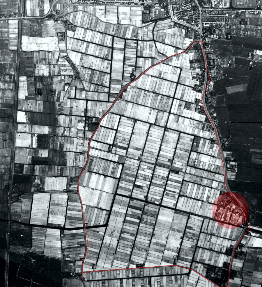
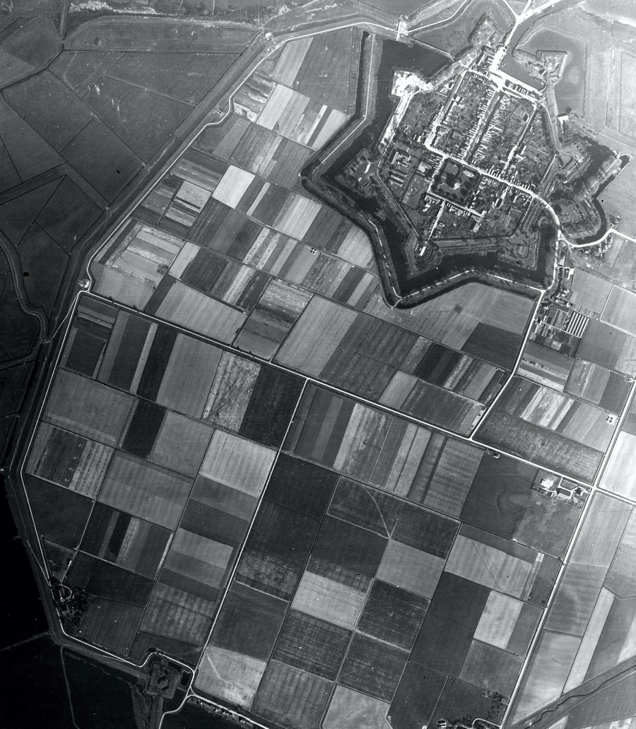
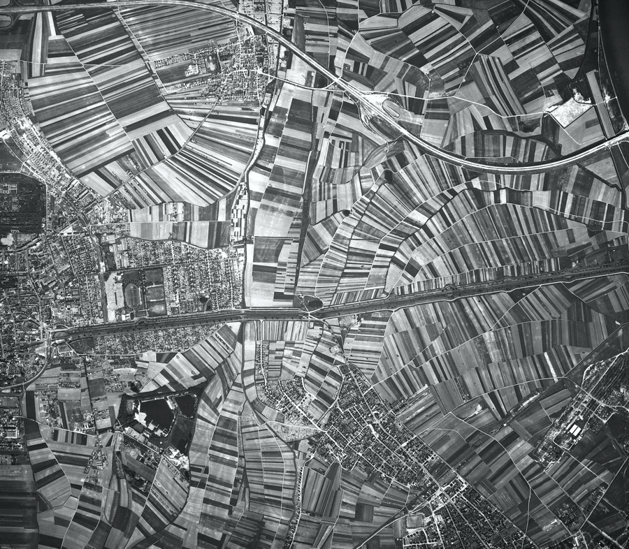
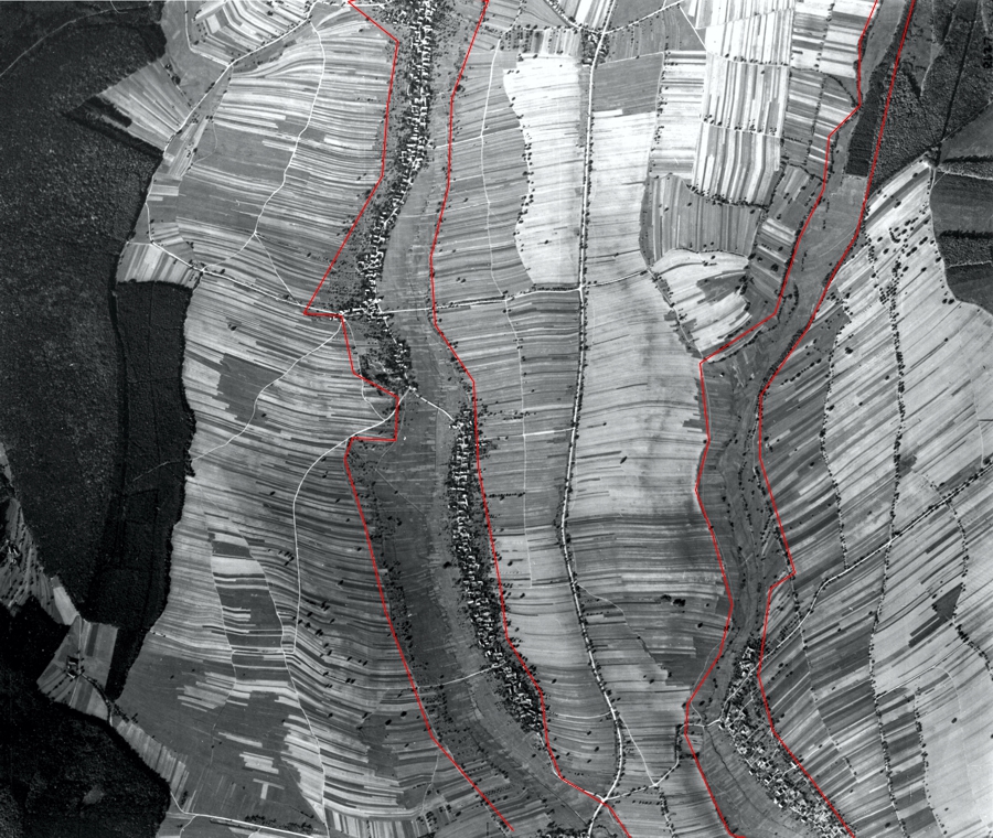
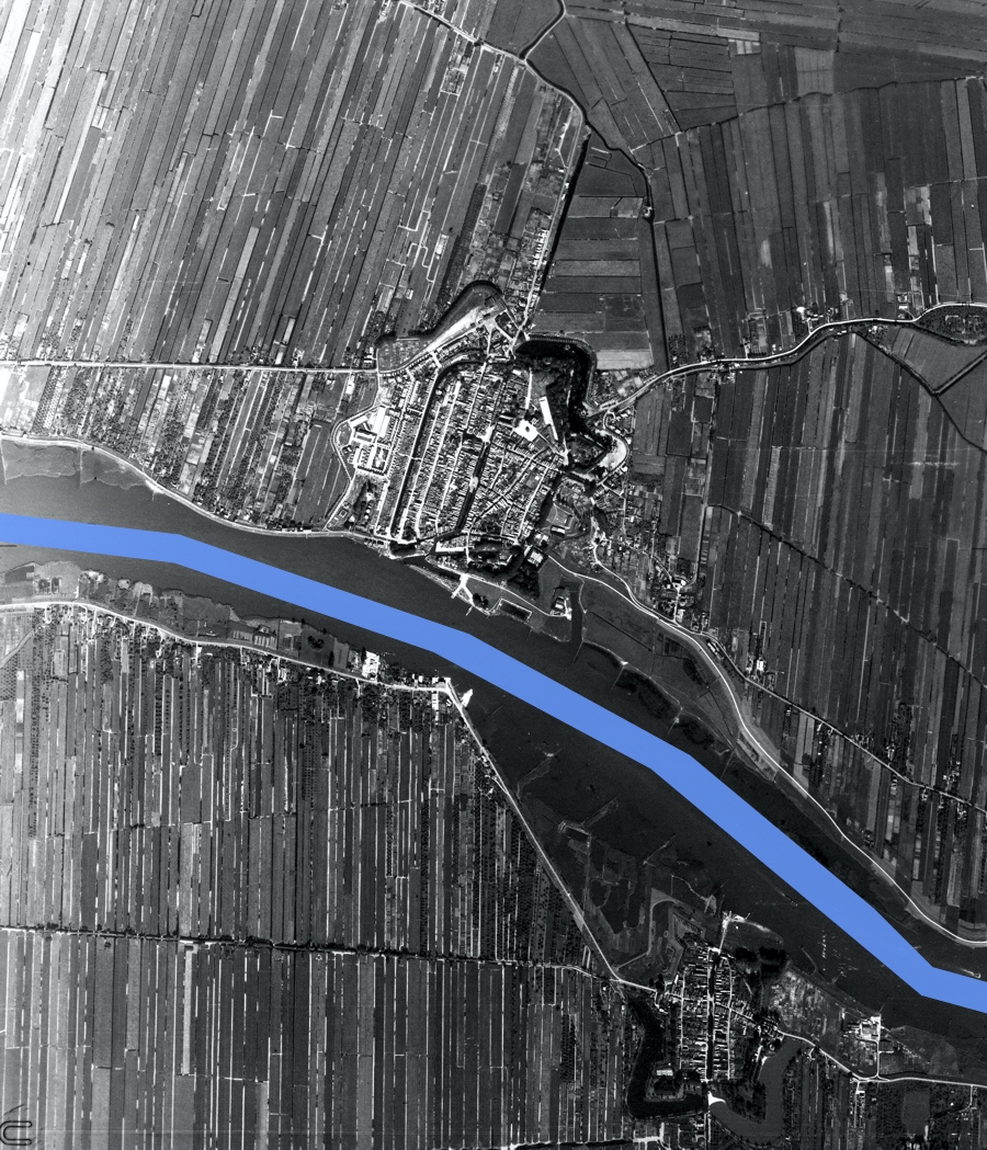
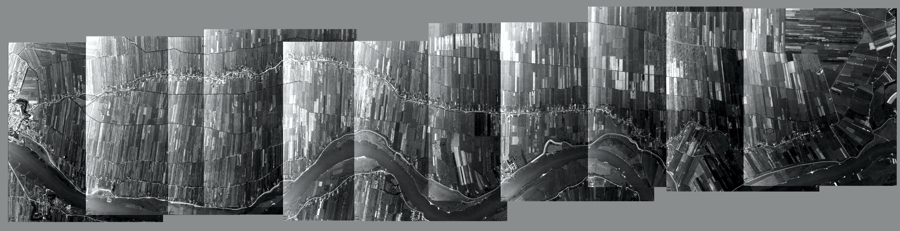
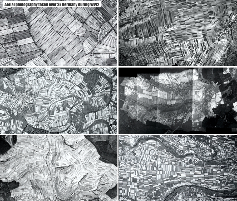
An introduction to The Field System Beyond the confines of the walled star cities and towns, lay the Field System. The field system of the StarCiv was staggering, both in it's complexity and beauty. This is a massive topic and this introduction will barely scratch the surface of the field system in its entirety. The field system is also intimately linked with the canal system and is best understood by studying the two subject - canals and fields, together. Integrated perfectly with the canal system and auxilliary structures, the field system was a working showcase of the StarCiv's achievements. Yes, they were exceptional stonemasons, but the world they created had to look gorgeous all over - and that's where their field system truly delivered. The StarCiv's culture appears to have been all about living in harmony with nature. To achieve this, they constructed the most fantastic cities and towns, buildings and gardens for localised society, but they covered the entire world with artistry in the form of their fields. The Field System may have had a practical use, quite possibly the generation of electrical energy - or as an environment for every species of animal - but these ideas are still being explored. There were different types of field system. There is also a large amount of regional variation within the Field System. Because we have been left with no documentation, or even folklore, about the StarCiv, certain suppositions have to be made, based on visual evidence and correlating factors. It must be remembered that many parts of the Field System have been destroyed or amalgamated by our own civilisation. However, large amounts of it still remain, either fully intact, or in a state of decay. There are a huge number of aerial photographs from WW2 that show, conclusively, much more of it was still in existence as late as the 1940's. Interestingly, aerial photography from WW1 amounted to tens of millions of photographs, the vast majority of which have been destroyed by fires at one time or another. I wonder why? There were three types of field that are evident: Standard Dry Field Type. These are the fields that are multi-tonal (i.e. each field next door to one another is a different shade to the one adjoining it) and their natural state is dry. The reason for the multi-tonality is unknown, but may be linked to translucent earth, which we'll look at later. There is a reason these are designated 'dry' fields - as we'll see in a moment. All of these fields had smaller feeder canals (fed from the local main canal) that surrounded each and every field - and these smaller canals fed into even smaller water runs that irrigated the fields. (The Field System is closely tied to the canal system, which is looked at in greater detail here) This diagram may help visualise the system: 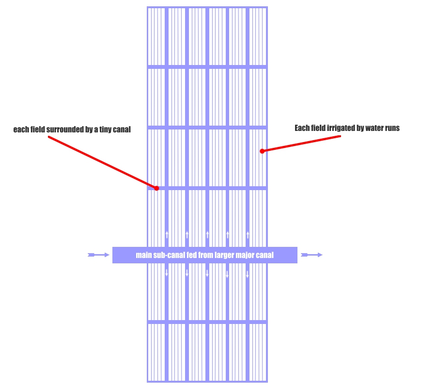 The sheer amount of construction work to create this canal and irrigation system, which covered almost every part of The Earth, boggles the mind. There must have been hundreds of millions of miles of canal feeding the field system, ranging from 20-100m wide main channels (which incidentally, we now call rivers), down to channels a couple of feet wide. Standard dry field type appears to have been the inland (i.e. not coastal) default type system. It is the massive majority of field system that was, and in many cases still is, in existence. The StarCiv liked to get creative with their field systems, especially standard dry type. They used intersectional angles extensively, which must have given the field system an almost super 3-dimensional look to it. Here's an example:
However, by far the majority of Field System is standard 'dry' layout - i.e. not linked to an estate. The field layout also varies from region to region, sometimes containing similar systems seems in other parts of the world, sometimes unique, but always, always conforming to the same setup - canals becoming incrementally smaller and smaller, surrounding and forming very intricate and deliberate field patterns. Regional variations of standard dry field system. It's worth remembering that because the StarCiv was worldwide, the regions that existed in their time do not necessarily correspond to our idea of countries and borders that exist today. Our landmasses may be different or altered, having been re-arranged during the event which destroyed much of the StarCiv. Further investigation of which type of fields lie in which regions may give us further insights into the actual purpose of the field system, but this is a massive project that will take considerable time. This is ongoing. That said, here are some examples of regional variation in the Field System -
Take a look at some of the field systems in Holland during the 1940's here Wet Field System - coming soon Mini-Field System - coming soon. Translucent soil - coming soon. Recap - the field system covered every part of the landscape in between towns and cities - it covered the entire planet in a patchwork mosaic of different coloured or hued soils - and it's purpose it unclear. It is one of the most staggering feats of construction imaginable. |